The
Punjab plain comprises mainly the province
of Punjab. It is the gift of River Indus
and its five eastern tributaries- Jhelum,
Chenab, Ravi, Sutlej and Beas. The plain
spreads from the south of Potohar plateau
up to Mithankot, where Sulaiman Range
approaches river Indus. The Punjab plain
is almost a featureless plain with a
gentle slope southward averaging one foot
to the mile. The only break in the
alluvial monotony is the little group of
broken hills(100 ft-1,600ft.) near Sangla
and Irana on either side of the Chenab.
The entire plain is extensively irrigated
by a network of canals. This system has
been greatly expanded and improved in
recent years by the construction of
link-canals, dams and barrages as a result
of the Indus Water Treaty with India,
which awarded the three western rivers
(Indus, Jhelum and Chenab) to pakistan,
and the three eastern rivers (Ravi,Sutlej
and Beas) to India. Tarbela Dam on river
Indus and Mangla Dam on River Jhelum,
which have water storage capacities of
11.1 million acre ft. and 5.55 million
acre ft. respectively, need a special
mention. Irrigation water is supplemented
by summer and winter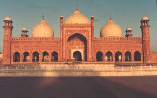 rains(15-20 inches) so that a variety of
crops is raised, the major onces being
wheat, rice, cotton and sugarcane. The
region has earned the name of granary of
Pakistan. However, the blessings of canal
irrigation have not been without a curse,
which render about 100,000 acres of land
unproductive every year through
waterlogging and salinity. The menace has
been greatly controlled through salinity
control and reclamation projects.
Agricultural development boosted
urbanization and industrialization so that
the region has emerged as the most
important economically developed area of
Pakistan, containing over 56 per cent of
the population and most of the commercial
and industrial centres of the country,
such as Lahore (2,922,000), Faisalabad
(1,092.000). Multan (730,000), Gujranwala
(596,000), Sialkot (297,000) and Gujrat
(154,000).
rains(15-20 inches) so that a variety of
crops is raised, the major onces being
wheat, rice, cotton and sugarcane. The
region has earned the name of granary of
Pakistan. However, the blessings of canal
irrigation have not been without a curse,
which render about 100,000 acres of land
unproductive every year through
waterlogging and salinity. The menace has
been greatly controlled through salinity
control and reclamation projects.
Agricultural development boosted
urbanization and industrialization so that
the region has emerged as the most
important economically developed area of
Pakistan, containing over 56 per cent of
the population and most of the commercial
and industrial centres of the country,
such as Lahore (2,922,000), Faisalabad
(1,092.000). Multan (730,000), Gujranwala
(596,000), Sialkot (297,000) and Gujrat
(154,000).
The
south eastern section of the region known
as cholistan is under-developed. This
tract is parched and thirsty. The summer
temperature average 51.7 oC and the area
remains under the grip of extremely hot
winds. The surface of this desert consists
of a succession of sand dunes rising in
places to a height of 500 ft. with
vegetation peculiar to sandy tracts. There
is no soil down to the lowest depth except
sand; bitter water is, however, sometimes
found at depth of about 80-100 ft.
The
Potohar Upland
commonly called the Potohar Plateau, lies
to the south of northern mountains and is
flanked in the west by River Indus and in
the east by River Jhelum. This 1,000-2,000
ft.(305-610 m) upland is a typical arid
landscape with denuded and broken terrain
characterised by undulations and
irregularities. These are a few outlying
spurs of Salt Range in the south, and
those of Khair Murad and Kala Chitta Range
in the north. Two seasonal streams-Rivers
Haro and River Soan-flow from east to the
west and after crossing the region in the
north and in the middle respectively, fall
in the Indus. River Kanshi traverses the
eastern part of the plateau from north to
south and drains into River Jhelum. These
rivers and other hill torrents have cut
deep valleys and are of little use for
irrigation. Agriculture is thus almost
entirely dependent on rainfall of 15-20
inches and on the small dams built in the
catchment areas of the streams.
Fields
of wheat, barley, jowar, bajra and pulses
are found in valley bottoms and on the
terraced slopes along river banks. A new
economic factor has been introduced by the
establishment of a few factories in
Rawalpindi and Islamabad and a large
industrial area in the
Taxila-Wah-Hassanabdal triangle,where a
large cement factory was already in
existence. The region is particulary known
for its oilfields in Khaur-Dhulian
neighbourhood, the ancient civilization
sites in Soan valley, the ruins and the
Buddhist University at Taxila and the new
capital, Islamabad, which stands north of
the old city of Rawalpindi(806,000) at the
southern slops of Murree hills, the
popular Holiday resort of the country.
Salt Range The ramparts of the Salt Range
stretching from east to west in the south
separate potohar upland from the Punjab
plain. The average height of the Salt
Range is about 700 metres, but near
Sakesar in Sargodha district, it rises to
1,500 metres, making summer pleasant. The
southern face is remarkably steep,
dissected and intensely arid. But, the
northern slope is gentle and has sparse
vegetation of oleanders and wild olives.
The top of the range is a narrow belt of
isolated plateaus and basins, where,
sparse stunted trees and fields of wheat
and maize are found. However, the real
importance of the salt mines lies in the
large deposits of pure salt at Khewra and
Kalabagh and the large seams of coal at
Dandot and Makerwal. Punjab Plain